This article originally appeared on The Otter ~ La loutre, 27 June, 2019. Link to original article.
By Josh MacFadyen and Nick Scott*
The roots of Canada’s food system run deep. They permeate every part of our geography and history, and they are shaped in turn by regional patterns and historical processes. But did the roots of our modern food system grow wild, at the hand of millions of market responsive farmers, or were they planted and planned by the state? Clearly the answer includes bits of both, and it changed over time. Modern agriculture is often called some variation of a revolution or a great transformation, but in reality it emerged in fits and starts. The twentieth century contained many cases of central planning in agriculture. It also included many modernization plans that failed, and others that were significantly reshaped by local communities. In Prince Edward Island a federal-provincial modernization effort known as the PEI Comprehensive Development Plan (CDP) illustrates the recency of – and frequent resistance to – high intensity agriculture in the Maritimes.
What follows is just one story, among the many tangled roots that we are tracing in the lab for GeoREACH (Geospatial Research in Atlantic Canadian History) at the University of Prince Edward Island. Taken together, these narratives help explain the central role that food and agriculture, and rural environments, played in the modernization of Canada and the world. They help us understand how policies shape land use and cover change over time, and how farmers sometimes make other plans entirely.
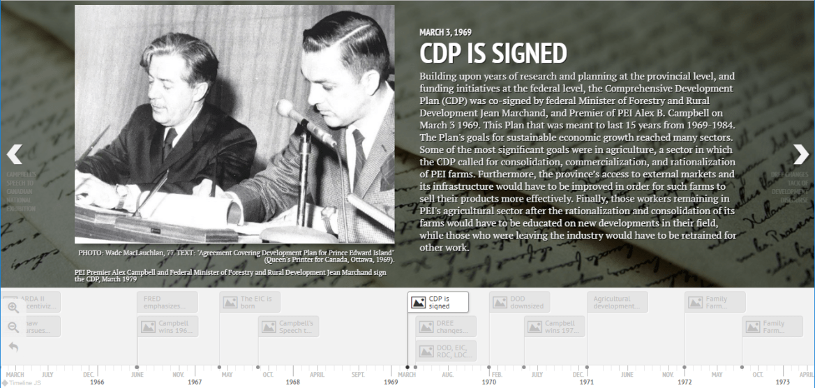
The Comprehensive Development Plan was more a rhizome than a root in this story. The larger plan has been called a watershed and even “the break” in PEI social and economic history. We created a timeline to illustrate its political and policy history (see below), but in this piece we focus on its role in agriculture. Signed in 1969, the CDP was originally intended as a 15-year long regional development initiative. It was meant to modernize practically every aspect of life on Prince Edward Island, ranging from agricultural development to educational reform. Managed in coordination between the Canadian federal and the PEI provincial governments, it was the most comprehensive, ambitious, and expensive regional development plan in Canada to that date. Its plan for agriculture, and the tepid response among Island farmers, say a great deal about the divergent visions of food and development in 1960s Canada.
When experts examined the region’s agriculture in the mid twentieth century, they often concluded that it was backward and inefficient. They recommended a judicious application of training, environmental resource data, and financial incentives so that farms could consolidate and become more specialized in commodity production. They also produced extensive maps and surveys for the Island that we are now able to incorporate into historical GIS research in the GeoREACH lab. Some of the surveys were illustrated by the National Film Board’s documentary on the CDP (see the video below), and many of the maps became part of the Canada Land Inventory (see the feature image). After decades of research into the region’s natural and economic assets, the experts tended to agree that the region could support a smaller number of profitable “commercial farms”; under the terms of the CDP they could even triple the net value output of these farms. However, as one report concluded, smaller farmers were reluctant to sell, and “it seems that the improvements in agriculture, needed to achieve this output, involve changes in rural society.”[1]
The Plan emerged within the post-war context of regional development and central planning. Following its 1961 predecessor, the 1965 Agricultural and Rural Development Act (ARDA II) was designed to fight regional disparity. It did so by stimulating growth in so-called peripheral regions and helping them to “catch up” with wealthier regions. Prince Edward Island benefitted from several such postwar initiatives, but the federal program that allowed the CDP to be truly “comprehensive” was the 1966 Fund for Rural Economic Development (FRED). ARDA tended to focus on distinct land use projects such as dams and drainage, but FRED offered much larger funding packages to regions if they implemented development plans that were fully comprehensive, meaning that they addressed both economic and social challenges.
Under FRED’s criteria, the whole of Prince Edward Island was designated as a “Special Rural Development Area.” PEI was the only province to receive such a designation in its entirety, but projects in provinces like Newfoundland and Quebec had important variations.[2]
PEI politicians like the Progressive Conservative Premier Walter Shaw were enamoured by ARDA and other research-intensive development projects. Shaw formerly served for two decades as the PEI Deputy Minister of Agriculture. In 1965, his government commissioned a series of reports on the state of the economy and society from Acres Research and Planning Limited. These reports would cover the potential for developments in agriculture, production and marketing, municipalities and urban centres, forestry and woodlots, and more. In May 1966, Liberal candidate Alex B. Campbell won the provincial election with a slim majority over Shaw, and he proceeded to assemble an agency that could take advantage of the FRED program and pursue federal funds for a comprehensive plan that would span the Island.
PEI Premier Alex Campbell (left) meeting with three farmers and cattle. Source: Alex Campbell Collection.
Building upon years of research and planning at the provincial level, and funding initiatives at the federal level, the Comprehensive Development Plan was co-signed by federal Minister of Forestry and Rural Development Jean Marchand, and Premier Campbell on March 3 1969. After Pierre Elliott Trudeau won the 1968 federal election his Liberal government sought to rein in both the budget and the governance of development projects while still expanding their reach. To this end, in April 1969 he integrated regional development projects into a Department of Regional Economic Expansion (DREE), and he made Marchand its first Minister. Thus, only a month after the signing of the CDP, a plan which emphasized comprehensive, ambitious, province-led development, a new federal government was emphasizing more focused, tightfisted, federally-led development.
Nevertheless, the province pressed on with its Plan. Its most important agricultural initiative was the Land Development Corporation (LDC). The LDC was a provincial Crown Corporation tasked with buying the lands of farmers who wanted to sell, providing pensions to older farmers who sold their lands to the LDC, and helping to retrain farmers who were exiting their industry to enter others.[3] By 1971, it was remarked that very little change had taken place in the agricultural sector. Although the CDP had implemented its programs and initiatives, farmers were not taking part. Local leaders suggested that under the Plan new programs be directed to the “family farm” to ensure their continuation and viability. This new Family Farm Program would give grants to farmers so long as they worked with extension workers and formed a five-year development plan for their farms. Farms had to be non-commercial, but they still had to net more than $2,000 per year in sales.The program was so popular that by November 1972 it was proposed that the original document laying out the CDP be amended to include the Family Farm Program.
In the end, the CDP produced mixed results for agriculture. Island farmers were commercializing and modernizing gradually. Although this was a trend the CDP originally acknowledged and encouraged, after the introduction of the Family Farm Program in 1972 it was something the CDP actively worked against. Alan MacEachern has shown that this inconsistency was rather consistent with other aspects of the CDP and Alex Campbell’s government in the 1970s. A 1973 report by two CDP planners stated the problem plainly. The province had excellent resources and every reason to adopt highly specialized and industrial agriculture. However, “social factors inhibit the modernization of agriculture throughout the Maritime Provinces and in other areas that have a long tradition of small farms.” The PEI farmer’s response to the CDP suggests that mixed farming, circular inputs, and pluri-occupational rural economies would not be easily displaced from the Maritime food system.[4]
*Nick Scott is a research assistant with the UPEI GeoREACH Lab, and a recent graduate of the BA Honours Program in History at the University of Prince Edward Island. His main work in the lab focuses on change over time in PEI’s agricultural policies, as well as the people, communities, and land these policies sought to improve.
[1]L. F. Bradley and Andrée Beaulieu, “Social and geographical aspects of agricultural land use in Prince Edward Island: A case study of the O’Leary Area” (1973). For more on the Canada Land Inventory see Shannon Stunden Bower, “Tools for Rational Development: The Canada Land Inventory and the Canada Geographic Information System in Mid-twentieth century Canada.” Scientia Canadensis 40(1) (2018): 44-75.
[2]Tina Loo, Moved by the State: Forced Relocation and Making a Good Life in Postwar Canada(Vancouver: UBC Press, 2019), 68.
[3]DREE, Development Plan for Prince Edward Island(Ottawa: Queen’s Printer, 1969), 33.
[4] Alan MacEachern, The Institute of Man & Resources: An Environmental Fable (Island Studies Press: 2003); Bradley and Beaulieu, “Social and geographical aspects of agricultural land use in Prince Edward Island.”
This article originally appeared on The Otter ~ La loutre, 2 April 2018. Link to original article.
Editor’s note: This is the third article in “Soundings,” a series of articles jointly published by The Otter ~ la loutre and the Acadiensis Blog that considers new approaches to history and the environment in Atlantic Canada. The entire series is available here on the Otter and here on Acadiensis.
by Josh MacFadyen and Andrew Watson
Environmental historians often search for signs of large scale energy shifts that help explain transitions at the societal and ecosystem level. Best known is the rapid adoption of coal and other fossil fuels during the late 19th century in urban-industrial economies, such as Britain, Germany, and the United States. Agriculture’s energy transition came much later, but it has received relatively little attention from historians by comparison. The articles in a recent special issue of the interdisciplinary journal Regional Environmental Change address this imbalance in energy history by asking how exactly the major flows of energy changed within bounded agroecosystems over the last two centuries. Our paper focuses on energy in Prince Edward Island’s agriculture. We found that energy transitions look different depending on the geography and scale of analysis, the quality (as opposed to the quantity) of energy, and the complex motives that shaped the decisions made by rural people. The results are illustrated by the experience of two families, the Munns and the Sheas, and the very different approaches they took to increasing their farm’s energy flows in the late 19th century.
Prince Edward Island offers a case study for examining the role of energy in eastern Canada’s woodland-livestock agroecosystems, or what some Canadian historians have called “agri-forestry.” Using a new model of energy analysis developed by members of the Sustainable Farm Systems project, our essay traces three forms of societally useful energy over four time points (1880, 1930, 1950, and 1995) that cover the transition from traditional, organic practices to modern, industrialized processes. Explained in greater detail in the open-access paper and online supplement, the three flows amount to all the energy contained in (1) the produce that leaves the agroecosystem, (2) the produce that is reused within the system, and (3) the energy introduced from outside the system. Included within the agroecosystem are all the organisms that inhabit the farmland, barnyard, and other non-managed portions of the farm. Outside the boundaries of the system exist the humans that managed and consumed these organisms (everyone from local farmers to more distant urbanites) as well as the various inputs that farmers acquire from society.
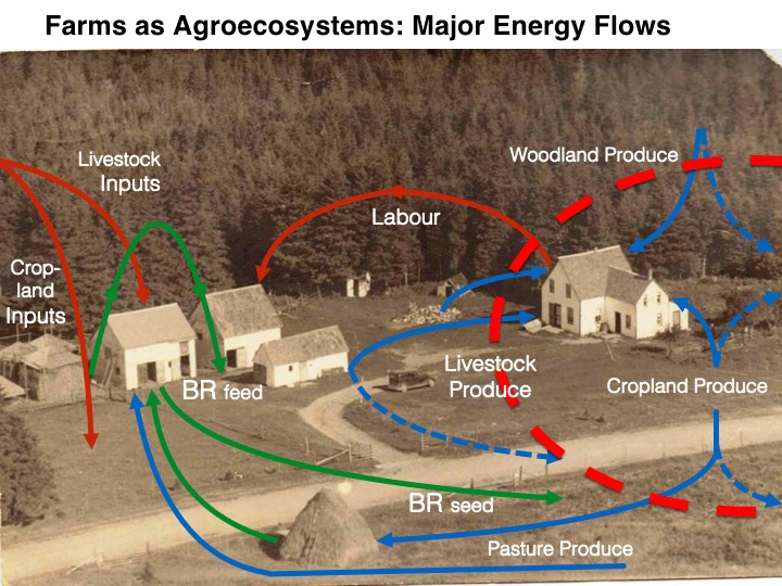
The following image shows the farm built by Thomas Shea in Groshaut, Kings County, PEI, with colour-coded arrows demonstrating the conceptual flows of energy in a variety of inputs, outputs, and internal flows. The red arrows indicate energy inputs that originated from outside the system. The blue arrows represent the produce outputs consumed by humans both on the farm (solid) and in distant markets (dashed). The green arrows indicate what we call “biomass reused” (BR) internal flows. Finally, the dashed red line shows the agroecosystem boundary, which is more a conceptual delineation than a geographic space. We converted all energy into gigajoules and divided those values by the system’s land area to allow comparison over time and between case studies at the local and international scales.
Major Energy Flows, over c1950 photo of T. Shea farm
Industrial agriculture represents an energy transition. Farms were once the world’s primary suppliers of energy. By the end of the 20th century, they were important energy consumers. When we started this research, we expected modest increases in the blue lines (outputs), decreases in the green lines (internal flows), and massive increases in the red lines (inputs). However, we were surprised by how consistent PEI energy flows remained at the provincial and county scales. A more careful analysis revealed that the quality of the energy produced stability. Particularly important were the non-comestible energy flows created by PEI’s mixed livestock and woodland use. Farmers required steady flows of internal biomass reused (green lines) in order to feed the herds. When some livestock types declined (especially sheep and horses), farmers replaced them with enough cattle, and later pigs, to keep the feed demand steady and increasing. Furthermore, the energy from woodlots remained a large component of the total output until at least the mid-20th century. When woodland energy outputs declined in the late 20th century, the concomitant rise of cropland outputs involved minimal new energy inputs from diesel and fertilizers.
Going Big
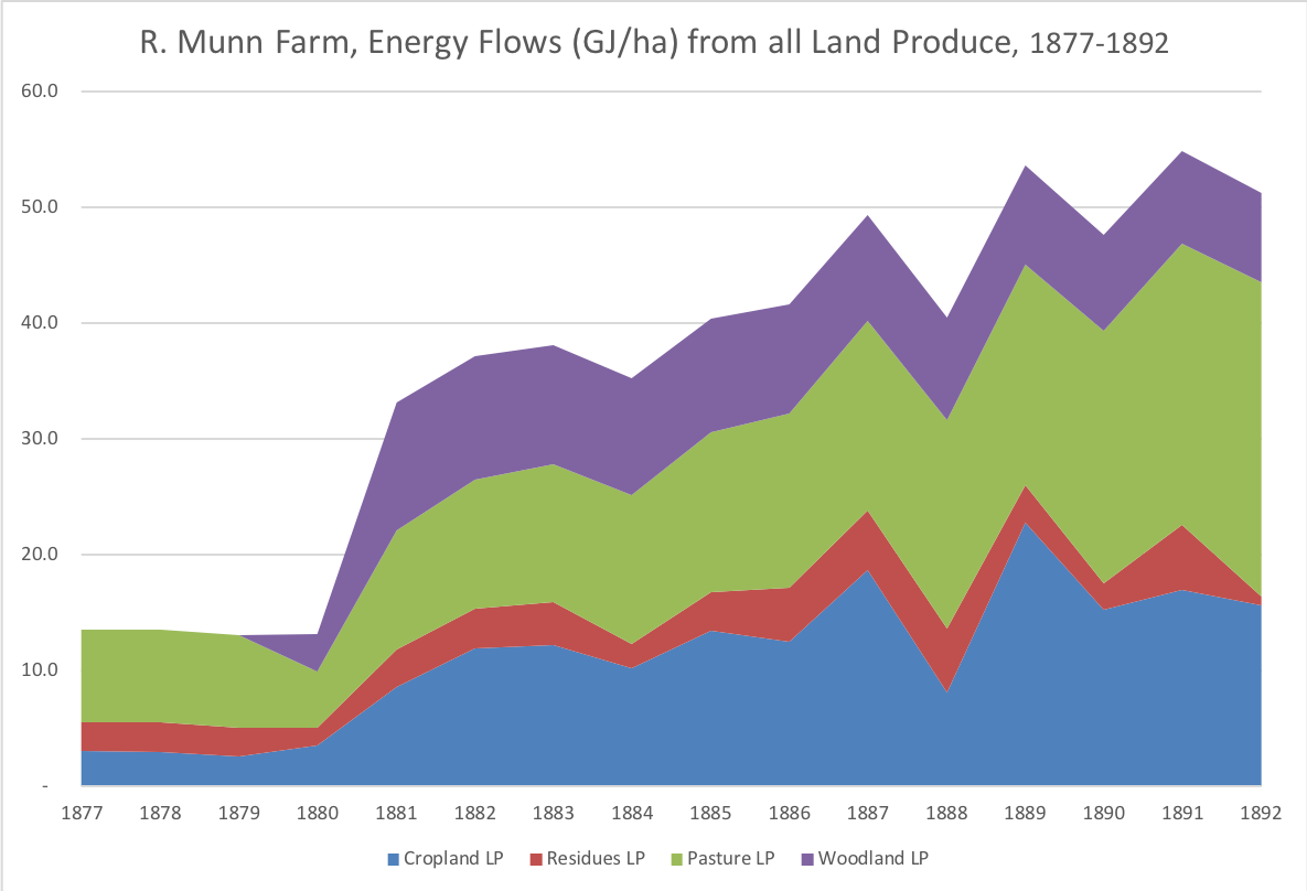
Farm-level energy information allows us to examine the energy trends within a single township in Queens County near the end of the settlement period during the late 19th century (1880). Gentleman farmer Roderick Munn raised horses, sheep, and likely cattle, but his focus was on maximizing the productivity of his cropland in Marshfield. He recorded crop types, planting, location, and output in great detail in his ledgers.
Marshfield got its name from the many small streams and estuaries running through it, which made a number of important riverine resources available. Munn’s farm was close to the island’s shore, but far enough upland that almost every acre was ideal for producing valuable energy outputs from crops and pasture. The Munn family also provided ample labour inputs. Roderick and wife Jane had six children, an ideal situations for intensifying farm productivity through labour. Between 1881 and 1891, there were always four or five working-age adults on the farm. Much of their work in those years was spent clearing a 25-acre parcel for pasture (and wood) produce. They also laboriously treated the remaining land with animal and estuarine manures, including 1,366 loads of PEI’s famous “mussel mud.” The result, shown in the chart below, was a significant increase in total energy outputs, particularly the pasture and fodder necessary for feeding livestock.
Going Spruce
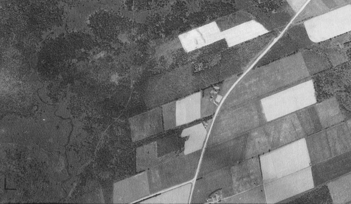
The expansion into the last of PEI’s agriculturally marginal lands in West Prince and East Kings counties, what our article calls “second fronts,” also increased agroecosystem energy outputs. The Shea farm in East Kings (shown in the 1950s, in the energy flows diagram above) is an example. Thomas and Johanna Shea built the small fifty-acre farm in Groshaut during the 1880s with their adult sons Dennis and John. Irish Catholic families like the Sheas joined a similar expansion of Acadian settlement in what became St. Charles Parish, a frontier community immortalized by Lawrence Doyle’s raucous Picnic at Groshaut.
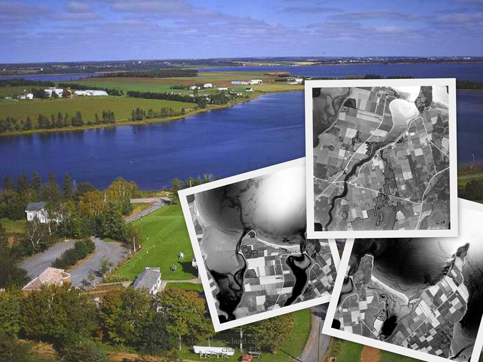
Between 1880 and 1930, Groshaut settlers aggressively cleared land and constructed farmland in the uplands. With an elderly father and no sons of his own, John must have done much of the labour as the farm intensified in the early 20th century. Like the Munns, the Sheas benefited from a large amount of wetland that was always described on cadastral maps as “vacant” or “Government Land.” Aerial photos from 1935 reveal Thomas Shea’s farm and the surrounding areas under intensive cultivation for crop and pasture energy production.
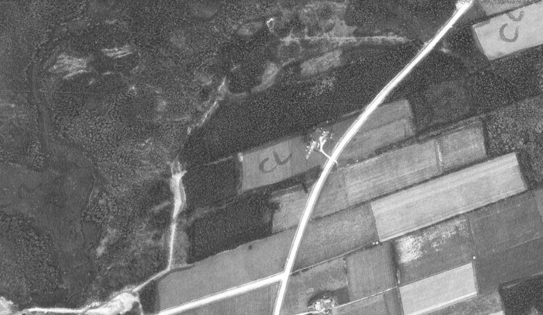
However, by comparing the 1935 photograph with one taken in 1958, we see that the second front had failed. The “woodland” visible behind the Shea home in 1958 had been farm fields in 1935, but had reverted to forest. The farm was, in the common Island idiom, “going spruce.” John Shea died in 1924, and although Agnes was listed as the owner of the original fifty-acre lot in 1927, all of the other land they farmed was by then “R.C. Church Property.” The 1958 aerial photo confirms that the forest was quickly taking over.
The energy implications of this transition had more to do with livestock than the value of forest produce. Livestock herds were always small and scrappy in the “second fronts,” and they became more so with marginal land abandonment. Although livestock density stabilized in PEI overall from 1880-1995, the herds were quickly beginning to concentrate in more intensive farming areas like Queens County. This was evident as early as the 1880s on farms such as Roderick Munn’s, but it accelerated in the mid-20th century. Kings County’s livestock density was stable in 1880 and 1930, but by 1995 it had dropped almost by half. The flows of reused feed, seed, and litter biomass remained similar to their 1880s levels in Prince, and increased somewhat in Queens. But in Kings, the disappearance of livestock dramatically reduced the prominence and importance of the internal flows of biomass energy needed to support the animals of the agroecosystem.
The implications for agricultural sustainability are difficult to predict. Recent reports have suggested that the decline in livestock is having a deleterious effect on soil health. We argue that a systems-based study of land use, including a long run examination of families such as the Munns and Sheas will help scientists and planners, as well as historians, understand the complex relationship between animals, society, and the land in Atlantic Canada over time.
The concept of the Anthropocene is useful, in both its metaphorical and geological senses, for defining our coordinates and setting our priorities. However, I would argue that like many of the meta-narratives of policy, sustainability, and environmental humanities in recent years, we need to ask, “Will it play in Peoria?”
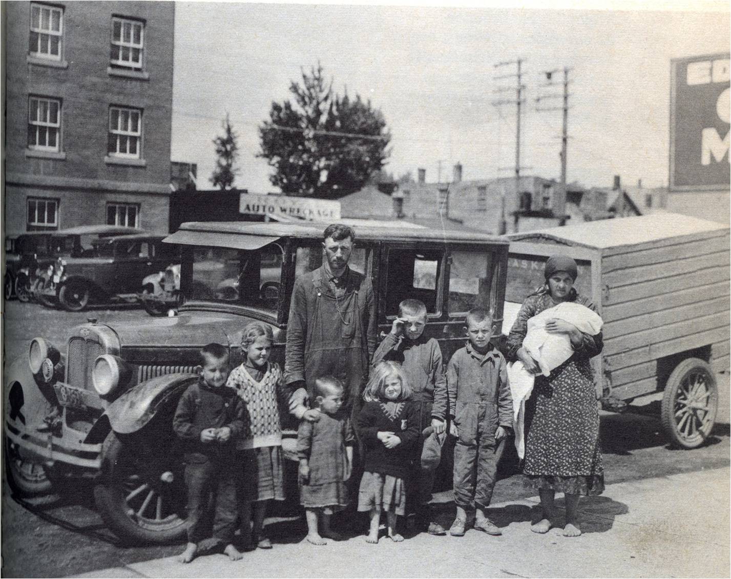
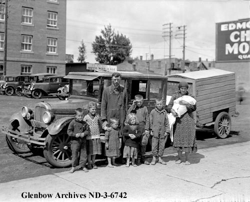
The Fehr family, Edmonton 1934. Source: Used with permission of Glenbow Archives, ND-3-6742
This expression dates back to vaudeville days when producers decided that Peoria, Illinois, was the testing ground for whether new shows – and later products of many kinds – would appeal to consumers in every region and demographic in the US. As environmental humanists, we would do well to ask the same question of our work, and as Canadian historians, we might also consider a much smaller and less central Peoria, the tiny crossroads community in the Peace River District of Northern Alberta. The impoverished Fehr family were retreating from a failed homesteading attempt there in 1934 when the photo shown above was taken, the moment helping illustrate the roles of telecoupled land use and everyday optimism in the emerging Anthropocene.
The promise of free, unplowed farmland beckoned this family into one of the final chapters in the Holocene’s dominant food history — agricultural extensification onto new land. But there’s a reason why the Canadian Shield and northern valleys have been called “places of last resort.”[1] The Peace Country is hard, and combined with drought and Depression-era prices, many families were driven back to consider other options. Increasingly, those options included employment in cities or in the Anthropocene’s dominant food system — intensive agriculture on settled land.[2] The overall amount of global domesticated land use began to stabilize in the late twentieth century, and a “Green Revolution” in intensive agriculture allowed a relatively small number of people to produce more food on less land. However, there is one crop type that continues to occupy more land in the Anthropocene, oil crops. Although many newcomers like the Fehrs were forced out in the 1930s, a postwar boom in oilseed production eventually helped farmers to plow up Peoria and the Peace District. By applying environmental history and theories about telecoupled systems, we are beginning to understand how this occurs and what it means for other places of last resort in the Anthropocene.
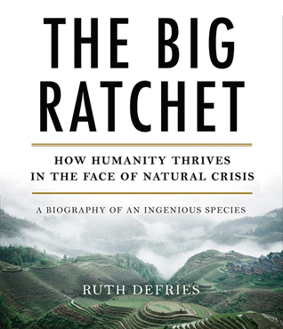
In some ways, the Anthropocene as a concept was never intended to play in either Peoria. Not many people spend their days thinking about epochs and whether we’ve entered a new one. We are perhaps more likely to think about whether our current age is unique and how that affects us and future generations. Other ecological metaphors and metrics such as “footprints” and planetary boundaries are more helpful in this way than is Anthropocene. To J. R. McNeill’s and his co-authors’ credit, ideas like the “Great Acceleration” and “something new under the sun” are much more accessible.[3] Other scholars have proposed different metaphors. For instance, Ruth DeFries explains the process of human development, overshot, and adjustment as series of historical ratchets, hatchets, and pivots, and to her the Great Acceleration is simply “The Big Ratchet.”[4] This description is accessible and optimistic, but the question remains: who will write the sequel, “The Big Hatchet?”
Optimist Prime
Other writers downplay the severity or even the probability of such a sequel. Time magazine published its first guest-edited issue in decades this January, its tone departing from that of almost every other journal in the past year. Its theme was “The Optimists,” and its guest editor was the bard of binary himself, Bill Gates. Gates is a true optimist, and he, along with Jeffrey Sachs and Bono, expects that extreme poverty and malnutrition will disappear from the globe at some point in the 21st century. World population will stabilize and scientific development, including genetically modified C4 rice and other Gates Foundation initiatives, has the potential to feed billions and even produce another Green Revolution. The Gates Foundation’s view of the Anthropocene is fundamentally optimistic.
Environmental humanists have recently wrestled with striking a balance between hope and caution, particularly when it comes to our interpretations of the Anthropocene. For starters, when someone claims they can spark a new Green Revolution, humanists typically pivot from the problem of “can they” to the question of “should they?” Similarly, in the field of energy, we often read that nuclear power is the only feasible clean alternative to the fossil fuel energy system. When detractors raise the issue of nuclear’s inevitable disasters, people like Gates have argued computational models are now so robust that they can account for all possible scenarios. (Every time an optimist says that, God kills a kitten or at least tosses a spent nuclear fuel cell into the sea.)
Humanists again face the question of whether to remain hopeful. I’ve often struggled to determine whether I’m a pessimist or an optimist. It didn’t help when my Shakespeare professor explained As You Like It by noting that the play’s optimist (Duke Senior) and pessimist (Jacques) draw the same conclusions: that this is the best of all possible worlds!
My ambivalence deepened when I developed the kind of split personality it takes to work in both a School of Sustainability and a School of Historical, Philosophical, and Religious Studies. Half of my students are driven by a desire to model the future, and half are mourning the past. I believe the Anthropocene needs both the mourners and the modelers, and preferably people who understand how to do both at once.
Humanists are well suited to train, and to be, those people. As Anna Rosling Rönnlund, the cofounder of Gapminder, argued in Gates’ January edition of Time, “To understand the world, we have to focus on the unsexy, everyday life in the middle.”[5] I would only add that we need to understand place – places like Peoria and the Fehrs’ ill-fated attempt to homestead there. One of the critical aspects of understanding the Anthropocene is in understanding the food system that makes life possible for so many people. The part of the Fehr story that interests me is not why they wandered through Edmonton as barefoot beggars in 1934, but what brought them and so many others to the Peace District to begin with and how so many farmers ultimately succeeded there.
A Telecoupled Anthropocene
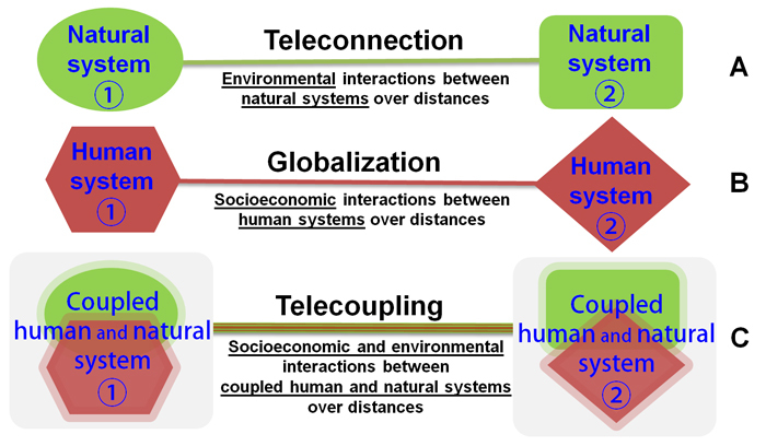
Figure 1: Telecoupling diagram, Source: Liu et al 2013.
Peoria and the Peace District illustrate one historically consistent aspect of the Anthropocene: the coupled human and natural systems that drive land use change across long distances. Ruth DeFries and other sustainability scholars have called this phenomenon “telecoupling,” and it helps explain a serious threat to ecosystems in the Global South.[6] Because of the rapidly increasing demand for agricultural commodities, fats and oils, and meat worldwide, southern farmers are putting new pressure on farmland including forests and on other previously unplowed land. They respond to global food prices, but they also respond to changes in other southern agro-ecosystems. The combination of global demand and shifting regional agro-ecosystems produces the telecoupling effect. The result is a bit like trying to follow the complex breezes of a butterfly effect, but knowing that the entire system is being influenced by a wind tunnel.
Oil crops are the single fastest growing land use type in global agriculture, and include well known crops such as palm oil and soybean.[7] The Canadian Prairies have also been one of the world’s leading sources of oilseeds, in the form of flax (linseed) and Canola (formerly rapeseed). When Abram Fehr took out an Alberta homestead in Peace River in the early 1930s, he was following the last large agricultural migration in Canadian history. The Peace District was a rolling river valley with minimal tree vegetation, and despite the harsh conditions of this northern land with moderate soils and a short growing season, farmers knew they could grow cash crops like barley and wheat. The Fehrs’ attempt failed after an early frost killed their first crop and a flood drenched the next.[8]
Many Prairie farmers of the day considered flax a “pioneer crop,” because it matured faster than most cereal crops, and when markets were good the oilseed could prove quite lucrative.[9] We don’t know whether Fehrs brought flax with them, but many Peace Country settlers did. The Peace River District went from growing 6 percent of Alberta’s flax in 1941 to 26 percent in 1956. Production was concentrated along the river and near the town of Grand Prairie, and unlike the ubiquitous cereals the flax crop was grown primarily by a handful of risk-tolerant farmers who watched Eastern markets carefully and tried to get into flax in an optimal year. The linseed oil market dropped after 1960, but it was replaced by the newly developed oilseed: Canola. The Peace River District’s oilseed empire began with flax, and after markets shifted, its farmers quickly substituted it with Canola in the crop rotation.
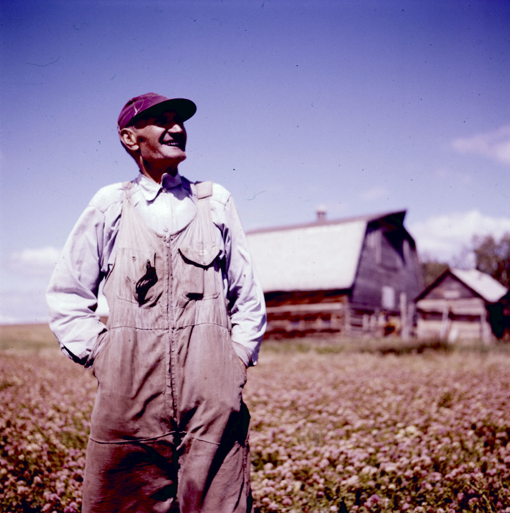
A farmer near the Peace River, 1954. Photo by Rosemary Gilliat Eaton. Source: Library and Archives Canada
Telecoupling is becoming one of the major models of Anthropocene land use change, particularly in terms of the palm and soy crops of the Global South. By examining similar oilseed commodities in a Canadian context we can see many of the same components at work in North America. Settler farmers benefited from liberal access to land and markets. They encountered environmental limits, and even disasters, such as depression-era droughts. They selected from a variety of subsistence, comestible, and industrial commodities, but ultimately changes in other systems determined the results. The Fehr photo helps illustrate how extensification ended with the Holocene. However, by examining the larger land use trends in Peoria and the Peace District, we see how telecoupled systems like oilseeds allowed new families to flood in, bringing along high-risk seeds like flax.
I hope that scholars of Canada’s Anthropocene will continue to think about how the epoch and the concept shape rural worlds. As we ask “will it play in Peoria,” we should be mindful of readers in middle (North) America, and we should think about how those places helped to create integrated food and agricultural ecosystems over time. I think it’s a good time for cautious optimism, for hope, and above all empathy. It is said that empathy rarely extends beyond our line of sight. As environmental humanists we have the ability to broaden sightlines, to places local and global and to lifetimes beyond our own.
[1] J. David Wood, Places of Last Resort: The Expansion of the Farm Frontier Into the Boreal Forest in Canada, C. 1910-1940 (Montreal: McGill-Queen’s Press, 2014).
[2] Helmut Haberl, Marina Fischer‐Kowalski, Fridolin Krausmann, Joan Martinez‐Alier, and Verena Winiwarter, “A socio‐metabolic transition towards sustainability? Challenges for another Great Transformation,” Sustainable development 19, no. 1 (2011): 1-14; Marina Fischer-Kowalski, Fridolin Krausmann, and Irene Pallua, “A sociometabolic reading of the Anthropocene: Modes of subsistence, population size and human impact on Earth,” The Anthropocene Review 1, no. 1 (2014): 8-33.
[3] John Robert McNeill, Something new under the sun: An environmental history of the twentieth-century world (WW Norton & Company, 2001); John Robert McNeill and Peter Engelke. The great acceleration (Harvard University Press, 2016).
[4] Ruth DeFries, The Big Ratchet: How Humanity Thrives in the Face of Natural Crisis (Basic Books, 2014).
[5] With that said, I’m rather glad that she designed the very sexy data visualization machinery behind Hans Rosling’s TED Talks, the animated time chart called Trendalyzer.
[6] Jianguo Liu, Vanessa Hull, Mateus Batistella, Ruth DeFries, Thomas Dietz, Feng Fu, Thomas Hertel et al. “Framing sustainability in a telecoupled world,” Ecology and Society 18, no. 2 (2013).
This article originally appeared on The Otter ~ La loutre, 1 November, 2016
Canadians have been hitting above their weight in the area of geospatial analysis since the development of the Canada Land Inventory and the world’s first Geographic Information System (GIS) in the 1960s and 1970s. Similarly, environmental historians and historical geographers have made great gains in Historical Geographic Information Systems (HGIS) research over the last decade, including several NiCHE projects, a 2014 edited collection, and now the Canadian HGIS Partnership. Canada is big. And in typical high modernist fashion, postwar scientists trying to fathom it ignored the knowledge of the rural, northern, and indigenous people who understood its land and water. Instead scientists turned to digital tools like GIS to examine and measure the nation. In what we believe is a post-normal and integrative approach, environmental historians are now both using the software and critiquing the normative processes it helped to create. But Canada is still big; its libraries, students, and other knowledge resources are very far afield. Our communities of digital scholars employ digital tools to collaborate and communicate our results across the continent. This post focuses on the students using these tools and the new ways historians are teaching HGIS online. This kicks off a series written by NiCHE and CHGIS collaborators on geospatial tools and analysis for Canadian historians.
I teach environmental humanities at Arizona State University, and although I am a Canadianist my Southwestern students are usually interested more in my knowledge of digital history, HGIS, and environmental history. I teach the many ways that digital tools allow us to explore the importance of place in the modern consciousness. At first I worried that I wouldn’t be able to shoehorn my Canadian research into my American courses, however, I discovered that place histories are surprisingly versatile in the classroom setting. They travel well in the digital medium. I also learned that many of my students are not Southwestern at all, mainly because of ASU’s growth in online teaching. In my first year I taught two courses to online MA students, one in Digital History and the other in GIS for Historians.
In the HGIS course, I decided to lead students through place history exercises, but I wanted to teach them using my familiar Canadian examples and then assign them group projects in the relatively uncharted territory of the Phoenix Metropolitan Area (PMA). So in the summer of 2016 twenty-six MA students learned basic GIS entirely online, they applied the skills they learned using data from Prince Edward Island, and they then worked in groups to recreate the historical geography of three “lost neighborhoods” in parts of the Southwest where many had never been.
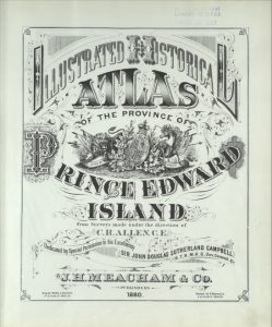
J. H. Meacham, 1880 Illustrated Historical Atlas of Prince Edward Island. Courtesy of Island Imagined.
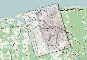
Learning HGIS online was possible in part because of The Geospatial Historian open access tutorial, which I explain below, and because of open source software like QGIS. Students were eager to try the software and apply it to the sample data from Prince Edward Island through the Geospatial Historian lessons. By working on new PEI case studies they were able to process historical maps from an 1880 atlas, “ground truth” their results in GIS, and then digitize the residences recorded on the maps. Students learned to georeference historical maps and determine whether the mapped features were appropriate for analysis at various scales. They worked individually, but the end result was a collective map of rural settlement patterns in the province.
Detail of a georeferenced historical map and the combined digitized house locations from the 1880 Historical Atlas of PEI. Each student digitized a different township, symbolized here by the different colours.
The students then turned to original work in the Phoenix area, and they eagerly tackled the tools and the projects because they recognized the importance of this work. The three neighborhoods we selected reflect some of the most critical social issues of our time: racism in residential schools, like the Phoenix Indian School, and poverty, migration, and segregation in Mexican American barrios in the Southwest borderlands. Two of these neighborhoods are virtual ghost towns in the middle of large Southwestern cities, yet in different ways they play host to their former residents.
The Phoenix Indian School was one of the largest and longest running residential schools in the United States. It was decommissioned by the federal government in 1990, but nearby Native communities are very active in its restoration, and recent efforts have led to historic preservation projects. One of the groups in
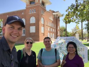
HST580 Group 1 site visit at Phoenix Indian School
my HGIS class made wonderful use of the technology and the digital records to recreate some of the important changes in and pressures on this now very valuable piece of Phoenix’s real estate. HGIS and the online forum facilitated their research and energized their work. And like the other teams, the Phoenix Indian School group asked local members to visit the site. These two students surveyed the site in the summer heat, and they interviewed local experts like Patty Talahongva, a former residential school student who is now working to build a memory and healing project in one of the school’s main buildings. (See the students’ Phoenix Indian School website here)
San Pablo was a Hispanic barrio completely erased from east Tempe, Arizona in the 1950s in order to make way for the expansion of ASU. Students in the San Pablo study group used several innovative methods, including Prezi videos and historical aerial photo interpretation to display the way this community lived in the early twentieth century. In some ways, San Pablo’s inhabitants return as part of the New American University’s initiatives to encourage enrollment from students of color and to make the student body representative of local demographics. (See the students’ San Pablo website here)
The third neighborhood, the postwar migrant barrio Victory Acres, is the only one of the three “lost neighborhoods” that still exists in the Phoenix Metropolitan Area. However, it was so radically reshaped by urban development in the 1970s and highway construction in the 1980s that in 1993 one local historian claimed that “Victory Acres shows just a few vestiges of the old barrio.”[1] Using a combination of local histories, historical aerial photographs, census data, and site visits, the students in this group reconstructed Victory Acres before and after the development of a major highway that isolated the neighborhood and removed many of its houses. (See the students’ Victory Acres website here)
Historical GIS is an optimal tool for researching and rebuilding lost neighborhoods, and it is possible to teach these skills in the classroom and even online. However, there were still many roadblocks ahead of us in this course. GIS training usually requires expensive software and many hours of technical training in a lab setting. Conducting historical geography projects often requires people with local connections to visit archives, find maps and other non-digital historical sources, and “ground truth” maps to explain problems in cartography, georeferencing, and historical data. We had limited technical support, no on-the-ground local supports, and only six weeks to run the course. Most of the students had little or no experience with GIS or historical geography. Furthermore, I was traveling and the course would be taught almost entirely away from my desk. It is remarkable that the students accomplished as much as they did.
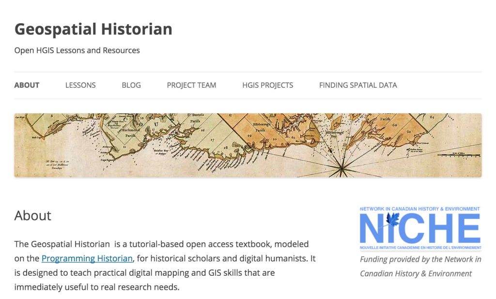
Fortunately, Jim Clifford, Daniel Macfarlane and I had produced an online open access tutorial designed to introduce historians to simple GIS project development and analysis. The website is called The Geospatial Historian, and following the model of the Programming Historian it was designed to teach students to use open source software for doing digital history. In June I presented the Geospatial Historian website at the Canadian Historical GIS network mid-term meeting (see slides here), and I discussed my plans to use it for teaching at ASU.
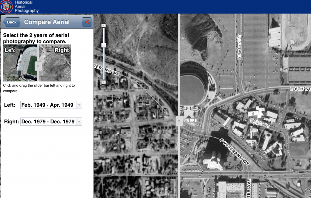
Another key to the course’s success was securing historical data from both ASU Library’s GIS data and Maricopa County’s Historical Aerial Photograph Collection. By using historical aerial photographs in a GIS, students were able to recreate large sections of these neighborhoods and compare change over time.
San Pablo and ASU Campus compared 1949-1979. In the 1979 imagery to the right (East) the appearance of parking lots, dormitories, and a stadium have visibly replaced most of the San Pablo barrio. Source: Maricopa County historical aerial photography
Historical GIS is a practice within the larger field of digital humanities (or as Ted Underwood recently described it using digits to understand the humanities). Richard White considered GIS a key part of the “spatial turn” in the humanities, and he argues that HGIS researchers often uncover more than they give themselves credit for. My students made innovative use of this new methodology to uncover the systemic racism of modern urban developments, from highways to university campuses. However, they emphasized the human stories behind the data. They recognized that a historical GIS is essentially a system for storing information and making maps, two skillsets that were pretty well codified in the early enlightenment. For all of its hype, HGIS is in many ways a computerized, map-enabled filing cabinet.
One of the central features of an historical GIS is to store and access large amounts of spatially explicit data. Like all historians, our filing cabinets collect a lot of information that will simply not appear in any way in a published project. The same is true for a GIS. Painstaking work on street-level, year-by-year data series can often result in a layer that is never published, or at least a layer whose historical attributes are not labeled or discussed. However, it is a tool that allows the historian to not only store the information but to process it and analyze it in completely unique ways. The new avenues for teaching environmental history and historical geography through digital history and projects like the CHGIS offer great promise for students of Canadian and other lost or changing landscapes.
Acknowledgements
I would like to thank the students of HST 580: GIS for Historians for their excellent work on these communities. I would also like to acknowledge the help and advice offered by many colleagues and GIS professionals, including Nancy Dallett (ASU), Eric Feldman (Maricopa County), William Kyngesburye (KyngChaos), Tammy Parker (City of Phoenix), Matt Robinson (ASU), Jared Smith (Tempe History Museum), Patty Talahongva (Native American Connections), Mark Tebeau (ASU) Philip VanderMeer (ASU), Karina Wilhelm (ASU Map Library), Mary Whelan (ASU GIS Librarian).
[1] Scott W. Solliday, “the Journey to Rio Salado: Hispanic Migrations to Tempe, Arizona” (ASU MA Thesis, 1993), 123.
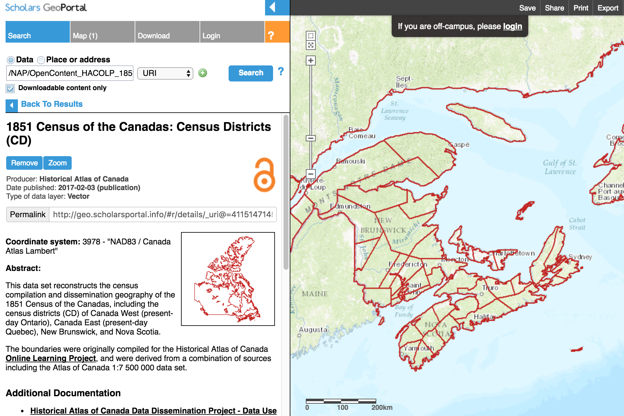
As a Collaborator on the Canadian Historical GIS Partnership I had the opportunity to meet with many of the incredible Canadians who are using Geographic Information Systems to advance historical research and presentation in higher education. The mid-term meeting was held in Toronto, and it included scholars and practitioners from across the country (and the US, of course). A summary of the highlights from that event can be found here.
Niagara Falls Aerial Photos (1934) on Scholars GeoPortal
Anyone who uses tools like Scholars GeoPortal or Montréal, l’avenir du passé (MAP) to retrieve historical data will want to check out the presentations in more detail in the program here.The GeoPortal is becoming an especially impressive repository and visualization tool for historical geospatial materials. Our parters at ESRI Canada also demonstrated some of the new functionality of ArcGIS Online and Story Maps viewers for the kinds of portal the CHGIS Partnership plans to develop.
My presentation focused on how I was planning to use ASU Online’s teaching platforms and the Geospatial Historian (the open source web tutorial I created with Jim Clifford and Dan Macfarlane) in an introductory summer course at ASU. Anyone interested in more information can check out my presentation slides here.
Acknowledgements: I am indebted to Dr. Penelope Adams Moon, Director of Online Graduate Programs at the School of Historical, Philosophical, and Religious Studies at Arizona State University for much of the material on ASU’s online programs. She has written an excellent piece about online teaching at Inside Higher Ed. Teach Online … Before It’s Too Late
Living for two months with six people, no furniture, and only what cargo we could cram into a small white minivan is strangely illuminating. That’s what I did this summer. I moved my family from Saskatchewan to Arizona, and I found the process of inhabiting mainly empty spaces a unique way of understanding priorities and place in our digital world. For the first month our goods and chattels were packed and stored while I waited for the gears of US immigration to turn and release my paperwork. For the second month those boxes languished at the border while I began my new position at Arizona State University. It was a bit like camping in houses.
It was illuminating for two reasons. First, it showed how low most of our stuff is on the new hierarchy of needs. WiFi routers are surprisingly high, and cell phones are just behind that. Small things make a big difference, and they reflect different priorities. Coffee makers and kitchenware are more valuable per cubic inch than shoes. You would trade your family heirloom bookcase for a pillow in a heartbeat. Nine-year-old boys will choose a WiiU over underwear. Every time. And geography matters. In Arizona, air conditioners are paramount, but hot water is unnecessary in the summer months. (I was taking “cold” showers for a few days before I realized that the cold water here is only slightly cooler than the hot.)
But moving so far and so often in the last 3-4 years has also reminded me that places and people come with you, and they travel more easily now than ever. Thanks to the various digital networks we build around us – from blogs to social media to networks like NiCHE – we don’t easily unsubscribe from place.
As routinely as we update our bills and addresses we peripatetic academics unsubscribe from department and other email lists soon after we move to a new town. Maybe me more than most. But we are less likely to unfollow old friends on twitter and social media. Twitter is really about place; my feeds are often about the people and groups at the places I love. The places I’ve left behind.
Twitter users followed by @joshmacfadyen (% by City) TweepsMap, Oct 2015
I still get emails from political parties seeking support in many of my former ridings, and I feel like I know more about those ridings than the ones where I cast my vote. Thanks to Twitter I know what local organizations are doing in Charlottetown, London, and Saskatoon just as frequently as I do in Arizona. The first place I go to find out if Canadians are celebrating or hating the Blue Jays is Twitter and Facebook.
Immigration historians will be the first to tell me that these digital networks aren’t exactly new. Emigrant letters and diaries are a fascinating resource for studying the mobile nineteenth century society. Even as a child, in 1980s Prince Edward Island, I remember my parents receiving steady mail from distant relatives who had long emigrated to Boston and other parts of New England. The part that captured my attention was the newspaper clippings and comics my Great Aunt Ruby would send us – surely the twentieth century equivalent of posting a cartoon to someone’s wall.
Other Prince Edward Island expatriates have waxed eloquent on their home province since the first rush of outmigration began in the late nineteenth century. One medium for their network was The Maple Leaf, a magazine launched in California in February 1907. The editor, Michael Ambrose McInnis, emigrated in 1889 and established a printing business in Oakland. The magazine operated until 1947, providing news and opportunities to generations of Martimers living in the United States during a period of steady outmigration. Aunt Ruby and Mike McInnis hadn’t unsubscribed from place either.
One key difference between The Maple Leaf and my digital networks is the absence of an editor like McInnis – although arguably they’re all still controlled by men living in California. For the most part I edit my networks, and my connection to place, both consciously and unconsciously. My networks are currently dominated, of course, by Canadians or at least people who care about Canada. As my local Arizonan networks grow they are displacing some of the northern content and creating no end of fascinating juxtapositions – climatological, political, cultural.
The TweepsMap of people I follow on Twitter suggests that my digital network is centered in the Northeast, and particularly in Ontario, Maritime, and Atlantic Seaboard cities (see above). However, I was surprised to see that the second largest state or province (after Ontario’s massive 26%) was Arizona. This state is already home to 7% of the people I follow.
As a Canadian in Arizona I’m keen to maintain some knowledge of current events as well as the research communities in the north, and these networks have been a useful way to do both. I’m happy to keep my subscription to place and to Canadiana. I may even start sending newspaper clippings to my nieces and nephews.
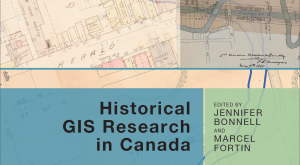
My chapter on Prince Edward Island’s changing landscapes and land use (Top-down History) was featured in the latest episode of the Nature’s Past podcast today. This was a roundtable interview with Jennifer Bonnell, Marcel Fortin, John Lutz, and me. We discussed the changing role of historical Geographic Information Systems (HGIS) in academic research, and the role of the new book edited by Bonnell and Fortin HGIS Research in Canada. I was able to speak to the advanced geospatial analyses I performed on Prince Edward Island’s environmental history, with the help of William Glen.
Sean Kheraj created Nature’s Past as one of the many digital initiatives of the Network in Canadian History & Environment (NiCHE). As he explains in this episode: “To help researchers in the field of environmental history get acquainted with the uses of [HGIS] technology, the University of Calgary Press and the Network in Canadian History and Environment have published a new book called, Historical GIS Research in Canada. You can read our review of the the book here.” The podcast was a really lovely way to cap off this excellent project.
Joshua MacFadyen and William Glen, [pdf] “Top-down History: Delimiting Forests, Farms, and the Census of Agriculture on Prince Edward Island Using Aerial Photography, ca.1900-2000,” in Jennifer Bonnell and Marcel Fortin eds., Historical GIS Research in Canada (Calgary: University of Calgary Press, Canadian History & Environment Series, 2014), 197-223.