Most people who visit small towns in Ontario tend to think of them as sleepy villages comprised of a few nice restaurants, B&Bs, and people who live there because they enjoy the sense of community and family roots. We know that these settlements exist because they were the location of a mill seat or they were situated roughly a day’s journey by horse & wagon from the nearest urban centre. These were service towns for the farming and resource communities of Ontario before motor vehicles and paved roads made it easier to access more distant cities. The mills and taverns are now replaced by upscale restaurants and boutiques; necessary infrastructure for a growing group of “rurban” residents who want to live, or spend weekends, within a couple of hours drive from their places of work.
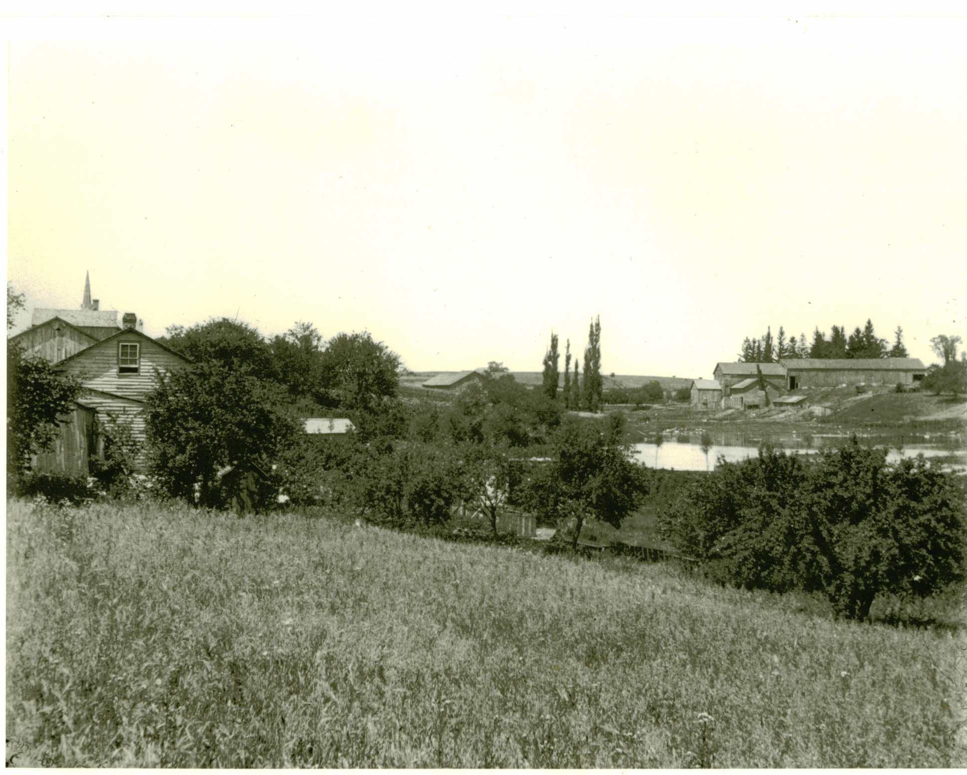
c. 1900, photographer Oscar Stroh stood behind the Schweitzer Hotel on King Street (now Sawmill Road), Conestogo and faced northwest to take this picture of the flax mill on Glasgow Street North. The mill is gone but the Ebel home remains. (Waterloo Region Generations)
It might seem from these preconceptions of rural and small town Ontario that they were relatively stable and static places. Sure, some services declined and local businesses could no longer satisfy all the shoppers from the surrounding area, but generally these towns changed very slowly and the streetscape remains similar to the way it was perhaps a century ago.
Actually the shape and structure of life in these towns was far from static, and in my PhD dissertation I used the case of a relatively obscure plant to demonstrate how. Flax was used for both its fibre and seed, and in Ontario where the fibre was processed by a network of small two-room flax mills it coloured the landscape with its blue flowers and brought hundreds and even thousands of labourers to the fields and mill yards to harvest and process the crop each August. But this post is about organizing historical data for small towns where change over time should be easy to track, but isn’t.
Some time ago I tried organizing my research on the industry in these towns and compiling the owners’ names and locations in a simple database. Again, I thought it should have been easy. Flax was a small industry, it was usually dominated by a single family with multiple mills, and thanks to censuses, directories, and rural newspapers there was a pretty good run of data on the owners and outputs. But this was much more difficult than I expected.
There was a lot of hype around Canadian flax during the American Civil War, and both the production and the number of mills grew from almost zero to dozens in a few years. But every time I found a new list of growers or millers, it was significantly different from earlier lists. Both the names of owners and the location of the mills had changed. And so I attempted to map some of these changes in a historical Geographical Information System (GIS). GIS was a lot of work to learn and although it helped demonstrate where, I needed other sources to explain why there and why then?
It turns out Ontario farmers hated the risk and labour associated with growing this plant, and so millers themselves had to produce much of their own raw material in a system that was sometimes called flax factorship. I explain that in other writings, but here I want to show that it might seem like millers hated growing flax, too. The location of mills in the late 1860s was in roughly the same part of southern Ontario as it was thirty or forty years later, and aggregate census data would tell you it was, but comparing the following two maps of detailed mill locations suggests that it wasn’t.
Just by uploading six different databases into this Google Maps Engine Lite app (see instructions at The Geospatial Historian) we can see that the central concentration of mills was moving westward across Ontario every year between 1865 and 1911. This was partly about the access to raw material – flax – but also about the suitability of small town business communities for incorporating flax production into the gamut of primary and secondary industries.
Flax mills were notoriously flammable, which contributed to the risk of operating a mill and the turnover in ownership over
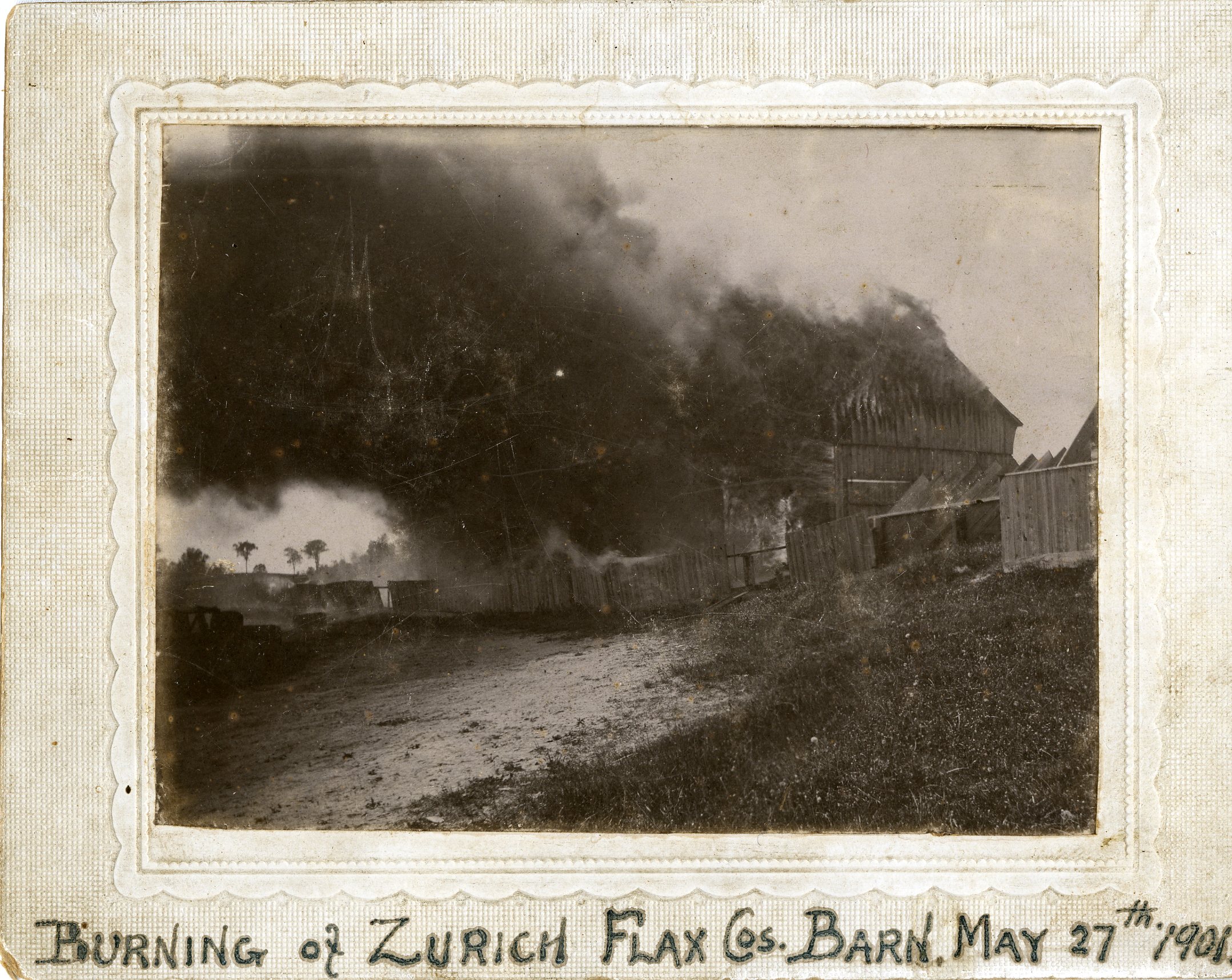
the years. It also contributed to their prominent place in Charles Goad’s and other Fire Insurance Plans and in another post I will show how mapping these sources helps us reconstruct the surprisingly busy and dynamic texture of small town streetscapes.
These maps show how a variety of sources may be used for determining the location of a flax mill in any given year. For 1865 and 1869 I used business directories, but 1871 was from the industrial schedules of the manuscript census (provided by Kris Inwood at the University of Guelph) and 1897 was from the business accounts of the largest flax miller at that time, James Livingston (available at Sir Adam Beck Archives in Baden, ON). Of course, using a variety of routinely generated sources helps identify errors and anomalies in other data. The different variables inside these datasets also help show the nuances and spatial trends within an industry like flax milling. Not only was it limited to this part of Canada and shifting slightly each year, but the blue markers show concentrations within the concentration by differentiating mills with more outputs. In 1897, the Dominion Linseed Oil mill was importing almost all of the flax seed in Ontario to make oil, paint, and varnish, but clearly the mills closest to Baden were much larger flax seed producers than the new mills in Huron County (The same kinds of trends can be presented by size of workforce or other variables.)
Flax seed from Ontario mills, 1897
Not only would the aggregate census be unhelpful for the precise location of these mills, the variation between census years was often significant. Even within two or three years there was a great deal of variation in mill location. Turning off one or two layers on each map shows the places where new mills were popping up and disappearing even between census years. The 1897 map (above) suggests one reason for this. Even though there were many small new mills opening each year in Western Ontario, there were also many small mills closing. It was an extremely competitive industry. And finally, the economic infrastructure and industrial landscape of Western Ontario was well suited to emerging new businesses like flax mills, even if they were risky ventures and prone to fire and financial disasters. Mills abounded in these towns and many mills and their sources of motive power and labour could be converted into a flax mill relatively easily. Lumber mills were particularly easy to convert to flax mills, and often proprietors of one were involved in the other.